The Weather at Durham in 2007
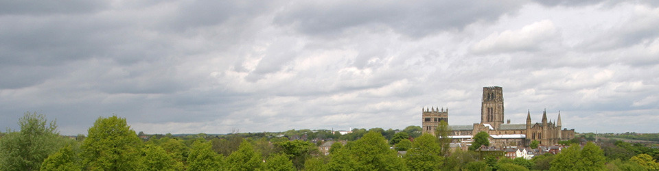
The Weather at Durham in 2007
The 4th warmest year at Durham since records began in 1850. No monthly average temperature fell below the long-term average. April was the warmest on record, and January the 2nd warmest. Rainfall, sunshine and wind speed were all just below the long-term average. Spring was the warmest on record and winter the 3rd warmest; there was also the 12th wettest summer on record. The Davis index of summer weather showed that Durham experienced its 12th worst summer since 1886.
January was the 2nd warmest on record since 1850; only January 1916 has been milder. Not surprisingly, given some record-breaking months in 2006, the 12-month average rose above 10°C once again, for the first time since January 2005. Rainfall was just below average, but sunshine was well above: it was the sunniest January since records began in 1882, beating 1959 by 0.1 hour! There were twelve ground frosts, mainly in the latter part of the month, with a similar pattern for the six air frosts. Very notable was the windiness of the middle part of the month. It was the third windiest January since 1953 (when the available record starts), beaten only by 1974 and 1975. There was a gust of 100 kph (62.5 mph) on the 10th.
February was the 19th equal warmest on record at Durham since 1850. There was a wide range of temperatures, from -4.2°C on the 6th to 13.8°C on the 2nd, the warmest February day since 1998 when 16 .7°C was registered. After the first few balmy days, cooler days were accompanied by some sharp frosts, with the grass minimum on the 6th being the lowest February value since 1994. There were 17 ground frosts, the overall average temperature notwithstanding. There were 8 air frosts, all in the period between the 3rd and the 10th. Rainfall was above average for February, although not remarkably so. It was another sunny month, although less sunny than the exceptional January. In general it was a calm month, but there was a gust of 88.9 kph on the 27th which was a very blustery day. With a mean air temperature of 5.6°C this was the 3rd warmest winter on record, beaten only by 1989 (6.3°C) and 1998 (5.7°C). It was also the 2nd sunniest winter since 1885-86; only 1999-2000 has been sunnier.
Despite some cold days, March was nevertheless a very mild month, with daily maximum exceeding 10°C on no less than 18 days. There were some chilly days in the middle of the month with a maximum of only 4.5°C on the 20th. Whilst not especially warm (equal 17th warmest since 1850), it was nevertheless more than 3°C warmer than March 2006. Like the rest of the north east, rainfall was low, unlike most of England, with less than 50% of the normal amount. It was sunnier than normal, the sunniest March since 2002. There were only 4 days without any sunshine, and the cumulative total for sunshine hours since the start of the year was now well above average.
April was the warmest on record at Durham since 1850, beating the previous record holder, April 1949, by a massive 0.9°C. Not surprisingly, both the mean maximum and mean minimum were records, the latter equalling the 2004 value. Only 17th April 2003 (24.1°C) has been a hotter April day in Durham than 16th April 2007. It was only the third time since 1962 that there has been no air frost in April in Durham. Although there were only two ground frosts, this is more than in both 2004 (1) and 2003 (0). From the 5th to the 15th, only one day had a maximum below 15°C with both the 5th and the 15th above 20°C, no doubt one of the warmest Easter breaks in Durham. April was also a dry month, the driest in Durham since 1997 and the 11th driest since 1852. Sunshine was well above average again in April, and the cumulative total remained well ahead of the average. Nevertheless, 17 Aprils have been sunnier in Durham since 1882.
After a glorious April, May felt dismal. However, it still turned out to be above average temperature, mainly because night-time temperatures were well above average. The absolute maximum temperature was the lowest since 1994, yet the absolute minimum equalled that in 2003, both being the highest since 1996. There were only two ground frosts and no air frosts. April was a relatively poor month for sunshine, the first month in 2007 to be below average. It was also more windy than normal, reflecting the unsettled weather this month. Despite 14 rain days and 9 ‘wet’ days (>= 1 mm), rainfall was just below average. This contributed to the 15th driest spring on record at Durham since 1852 (82 mm) and the driest since 1997. Despite May’s relatively modest temperature, it was still the warmest spring on record (9.4°C), beating the previous record in 2003 by 0.1°C. Other than 1945, the top five also include 2002 and 2004.
If May was disappointing, June felt dismal. Nevertheless, daytime maximum temperatures were exactly average for the time of year, while night-time minima were a little above average. June was thus, overall, just a little above average temperature therefore. The absolute maximum air temperature was lowest for June since 2002, but the absolute minimum was one of the higher on record, 4th equal highest since 1962. June was a very wet month, but not like many places nationally, the wettest on record. Overall, this was “only” the 7th wettest June at Durham since 1852. It was the wettest since 1997 (190.1 mm), which is only exceeded by 1980 (191.4). It had only the largest number of rain days in June since 2000. June was a gloomy month, the worst June for sunshine since 1987 (the record holder with only 89.4 hours of bright sunshine), and overall the 4th lowest total on record since 1882. There were 7 days with no sunshine at all, a total not experienced in June since 1997. It was less sunny than May, which was itself less sunny than April. It might be thought that this ‘reverse’ sequence would be unique, but in fact it has now happened 7 times in the April-June period since 1882, most recently in 2002 (The others are 1902,1912, 1954, 1984, 1990). Finally, June was rather less windy than normal with the lowest mean wind speed since 1999.
July was another disappointing month, although not as unusual as reports in the media suggested. Mean air temperature just about exceeded average, on the basis that nights were warmer than usual, balancing the relatively cool days. This June had the same mean air temperature as 2004 and 2002, and better than the 14.1°C in 2000. Memories are clearly short when it comes to a cool July! There was the lowest maximum temperature since 1965, which probably accounts for the feeling of disappointment. Following the 2nd driest on record in July 2006, this was the wettest July since 1940 and the 12th wettest since 1852. Even so, it hardly competed with the wettest July on record, 206.6 mm in 1888. There was an exceptionally heavy fall of rain on the afternoon of 18th, lasting an estimated 32 minutes either side of 15:00 hours BST; 19.2 mm fell at a maximum hourly rainfall intensity of 36 mm per hour (This is calculated on the basis of the highest 10-minute running total during any hour). Given a very wet June too, this was the 10th time at Durham since 1880 that two months in a row had received over 100 mm rainfall. For the record, the others were: 9/10 1880, 7/8 1891, 7/8 1930, 12/1 1938/9, 7/8/9 1950, 9/10 1976, 4/5 1983, 10/11 2000. Looking at the long-period totals, the 12-month total to 31st July 2007 was the highest since December 2004; the 3-month total was the highest since October 2004. July was the 3rd month in a row with below average sunshine. Even so, it was only the dullest July since 2001. Curiously, despite all the rain, there was only one day with no bright sunshine.
Despite a bad press, August temperatures were just above average. It was the coolest August since 1999 but still ranked 56th warmest in 158 years. There was the lowest minimum temperature since 2000 but only the lowest maximum since 2005 (when the maximum was only 22.1°C). August was a dry month, well below average. There was the fewest number of rain days since April. Despite low rainfall, sunshine was just about average.
For the summer as a whole, it was overall 0.35°C above average, the coolest since 2000, but still ranking 57th warmest in 158 years. Despite the low August rainfall total, it was still the 12th wettest summer on record, but only the wettest since 2004.
Perhaps it was the combination and high rainfall and average temperatures that made the summer seem so poor in many people’s eyes? The Davis (1968) index of summer weather weights temperature, rainfall and sunshine to produce an overall index of how good the summer weather has been. On this basis, 2007 ranked 12th worst since 1886 and the worst since 1987. 1976 tops the list with 2006 ranked 8th best. The contrast with last year seemed to be what strengthened the sense of disappointment.
September was above average temperature but not nearly as warm as September 2006. Daytime temperatures were above average (not remarkably so), whereas night-time temperatures only just so. It was a dry month, with the lowest number of rain days since 1985. It was the first September since 1988 with sunshine every day, but even so, the overall total amount of sunshine was below average.
October seemed mild, due largely to warm daytime temperatures. Even so, the previous two years had higher mean maximum temperatures. Night-time temperatures were a little below average. Consequently, the mean air temperature was above average, but not notably so. The absolute minimum air temperature of -6.6°C on the 24th was the lowest for October since 2002. It was a very dry month, with only 14.4 mm in total. Indeed the past three months were notably dry and the 3-month total was therefore well below average. It was the 5th driest October since 1852, with only 1969, 1972, 1962 and 1947 having been drier. Similarly it was the 5th driest August – October period on record, with only 1959, 1972, 1947 and 1955 being drier. Sunshine was around average, but it was a noticeably calm month with wind speeds well below normal, through a lack of vigorous depressions crossing the region. Yet again, the mean air temperature was above average in November.
November was the equal 23rd warmest since 1850. The maximum of 17°C on the 2nd was the warmest November day since 1982. As in October, wind speeds were below average, another relatively calm month. Overall, it was the 12th warmest autumn on record (10.2°C, equal with 2004), although a huge 1.8°C below last year’s record.
Temperatures were exactly average for December, some mild days at the beginning and end of the month balancing some very cold days in the middle, notably on the 14th when a maximum of only -0.6°C was recorded. Sunshine was just a little above average, with rainfall and wind speed just a little below. There was the highest number of ground frosts since 2001 and the most days without sunshine since 2002.
2007 was the 4th warmest year at Durham since records began in 1850 (9.83°C), equalling the 1949 and value and only exceeded by 2003 (9.88°C), 2006 (9.94°C) and 2004 (9.96°C). The 12-month running mean was above 10°C from January until September; the ‘year’ from June 2006 to May 2007 was the warmest on record at 10.77°C. The mean maximum for the year (13.6°C) was the 8th highest (since 1900) while the mean minimum (6.1°C) was 4th equal highest. Remarkably, the mean air temperature did not fall below the 1961-1990 average in any month (Using the 1971-200 averages, July, August and December were below average). Rainfall, hours of bright sunshine and wind speed were all just below average for the year as a whole. Seasonally, spring was the warmest on record and winter the 3rd warmest; there was also the 12th wettest summer on record. The Davis index of summer weather showed that Durham experienced its 12th worst summer since 1886.
Professor Tim Burt
Department of Geography
Durham University