The Weather at Durham in 2008
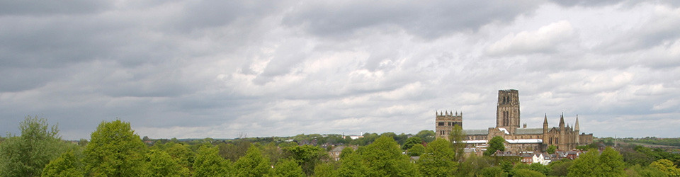
The Weather at Durham in 2008
The coldest year at Durham since 1996 (9.3°C) but still the 19th warmest year since 1850! A wet year, the wettest year since 2000 with the most rain days since 2002. A disappointing summer, daytime temperatures especially.
Despite a few cold days, January provided yet another month with above average temperatures. It was the 12th equal warmest on record since 1850. However, both 2007 (the record holder) and 2005 were warmer. It was the wettest January since 1939 and the 5th wettest on record. It was a windy month too, with a maximum gust of over 100km/hour on the 26th and one nearly as strong on the 25th.
It was the 44th warmest February since 1850, a mild month therefore, but not exceptionally so. Night-time temperatures were only a little above average, but daytime temperatures were much more so, the mean maximum temperature being the 12th highest since 1900. There was an extraordinary temperature range during the month from -6.5°C to +14.6°C; the night-time minimum went from -6.5°C on the 20th to +7.7°C on the 22nd! Despite the lowest minimum temperature since 1994, the number of ground frosts (11) was not exceptional. It was the driest February since 1998, the 5th driest on record since 1850. It was the 5th sunniest February since 1882 (111.7 hours), the sunniest since 1988. The sunniest February at Durham was 1907 with 116 hours of bright sunshine, so, although it was nationally the sunniest February on record (since 1929), no records were broken at Durham. It was very windy at the beginning and end of the month, but wind speeds were only average overall. There was a very strong gust of 60kt (111kph, 69.5mph) on the afternoon of the 28th; this is probably the strongest gust since 8th January 2005 (137kph, 86mph) and one of the highest ever recorded at the Durham Observatory.
It was the 14th equal warmest winter since 1850 (4.7°C), but not as warm as last winter (5.6°C) which ranks 3rd. Despite a very wet January, winter rainfall was only just above average as a whole. Overall, it was the 9th sunniest winter on record at Durham (216.9 hours), but not in sunny as last year (240.8 hours).
Although March seemed cold, it was nevertheless warmer than average using 1961-1990 figures [although slightly below average (-0.1°C) using 1971-2000 figures]. The mean air temperature ranks 100th in the 159-year record. There was the lowest absolute maximum for March since 1996. Like last March, it was a dry month and all long-term averages were now below average, a distinct contrast with later in the year. Sunshine was only just above average, and hardly sunnier than February. The sunniest day was, unusually, the 2nd. It was the windiest March since 1979, 5th windiest on record since 1953. It was very windy at the start of the month and just before the Easter weekend.
Though disappointing, especially the first half of the month, April was still just above average temperature. It was the coolest April since 2000, with the most ground frosts since 2001. It was also a wet month, the wettest April since 2000. Sunshine was well below average, and indeed it was less sunny than March. It was windier than usual with high wind speeds at the beginning of the month continuing the breezy end to March.
Despite seeming somewhat disappointing, perhaps because there was only an average amount of bright sunshine, it was nevertheless the 17th equal warmest May at Durham since 1850, the warmest May since 2003. It was also a dry month: the driest May since 2005 and 22nd equal driest on record. There were the most days without bright sunshine since 1993. It was also a relatively calm month, with a maximum gust of only 48km/h.
A new automatic weather station (AWS) was installed on 3rd June. This meant some inevitable teething troubles: initially some problems that lasted throughout June and then a more intractable fault in the tipping rain gauge that started in the middle of August and was not fixed until the end of October. The total sunshine hours figure for June was estimated from the Met Office website; daily rainfall figures were estimated using Environment Agency observations from the nearby Barker’s Haugh and Esh Village rain gauges. Happily, the AWS worked well thereafter and the Met Office, recognising the importance of the Durham record, has ensured that the AWS is now fully serviced as necessary.
Temperatures in June were slightly above average. The highest maximum was 24.2°C on the 8th and maxima did not exceed 20°C after the 9th, a somewhat disappointing state of affairs. Rainfall was above average, although not exceptionally so. It was a relatively calm month, with mean wind speeds well below average. Judging from the Met Office website, sunshine was a little above average.
Temperatures in July were well above average, but not exceptionally so, mainly due to some warm days at the end of the month. It was the 4th wettest July on record since 1850 (134mm). Remarkably, July has been much wetter on three occasions: 1930 (183.9mm), 1867 (184.9mm) and the record-holder, 1888 (206.6mm). Remarkably, the daily rainfall total exceeded 20mm three times: 23mm on the 31st, 23.8mm on the 9th and 27.6mm on the 6th. Even so, there were only 15 rain days, two fewer than last year.
August was another disappointing month, mainly because daytime temperatures were never very high, with the lowest daily maximum in August since 1992 (22.1°C). Mean maximum temperature was exactly average but mean minimum temperatures were well above average (but only the highest since 2004); consequently mean air temperature was above average. August was another wet month: 31st wettest in 159 years. Sunshine hours were well below average only about 65% of normal.
For the summer as a whole, mean air temperature was 0.3°C above average, 103rd warmest in 159 years. It was the 8th wettest summer on record (296.5mm), easily beating last year’s total (254.4mm). Looking at pairs of summers, 2007 + 2008 was the 4th wettest pair on record since 1850 (550.9mm), beaten only by 1927-28 (552.6mm), 1930-31 (576mm) and 1866-67 (593.8mm). Despite feeling so dismal, average hours of bright sunshine were only just below average for the summer as a whole.
Despite seeming another disappointing month, September was above average for mean air temperature. Daytime temperatures were below average but like August this was more than compensated for by night-time temperatures being rather more above average. There was one ground frost, the first in September since 2004. September was another wet month – but not as wet as some places nearby. The very heavy rainfall in the Morpeth area on the 6th stayed too far north to affect Durham; nevertheless there was a high flood on the River Wear because of heavy rain in the Pennines, and water levels stayed high for an unusually long period. By the end of September, the 6-month rainfall total moved above 500mm for the first time since March 2001, the 3-month total was above 300mm for the first time since December 2000, and the 12-month running total was highest is since November 2004.
Mean air temperature for October was well below average, the first time since March 2006 when mean air temperature had been below average, a remarkable run of 30 above-average months therefore. Mean minimum temperature was the lowest since 2003, while both mean maximum temperature and mean air temperature were the lowest since 2004. The absolute minimum was, with 2002, the lowest since 1997. There were 10 ground frosts, the highest total for October since 1986. The grass minimum was the lowest since 1997. It was a sunny month, considerably sunnier than September. Nevertheless, rainfall was above average. The 12-month running total was now the highest since September 2001. It was also a windy month, with a gust of almost 80km/h on 25th.
Although November ended on a very cold note after some very mild days in the middle of the month, the mean air temperature of 6.5°C was still the 121st highest in 159 years. The end of the month saw great contrasts in weather: there was a maximum temperature of 15.6°C on the 27th but a maximum of only 1.5°C on the 30th. The minimum air temperature of 8.2°C on the 27th was followed only two nights later by a minimum of -5°C! Rainfall was below average for the month, but the 6- and 12-month totals still remained well above average. It was the 13th sunniest November since 1882 but the November total (81.1 hours) was exceeded as recently as 2005. 1947 was the sunniest November at Durham with 120 hours.
It was the coldest December since 2001. It was the second time in three months that monthly mean air temperature was below average. It was notably cold on the 31st with a maximum below zero (-0.3°C). There was the highest number of ground frosts in December since 2001. The lowest grass minimum since 1995 was recorded on the 1st, continuing the very cold end to November. Rainfall was just about average for the month, but the 6- and 12-month totals remained well above average. It was nevertheless a very sunny month, the 7th sunniest December on record. Even so, this December total was exceeded in 2003, 2004 and 2006.
2008 was the equal coldest year (with 2001) at Durham since 1996 (9.3°C). The 12-month average (9.25 to two decimal places) is the lowest since October 2001, and 1.51°C below the maximum 12-month running mean in May 2007. Even so, it was still the 19th warmest year at Durham since 1850! Daytime temperatures were disappointing, in August especially; nevertheless, the maximum for the year (26.1°C on 27th August) was higher than the maximum in 2007. It was a wet year, the wettest year since 2000 with the most rain days since 2002. The total sunshine was a just little above average.
Professor Tim Burt
Department of Geography
Durham University