The Weather at Durham in 2010
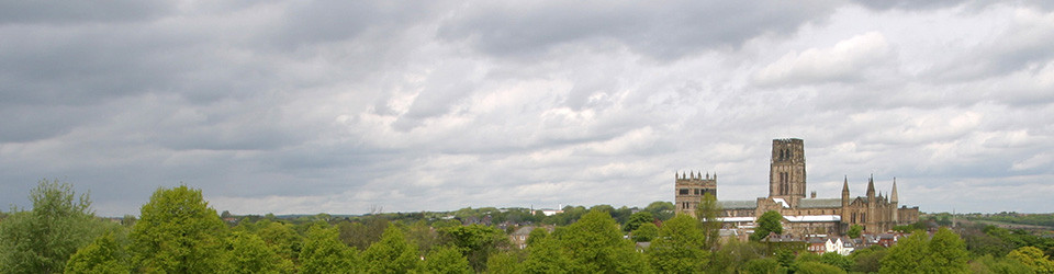
The Weather at Durham in 2010
After the coldest December for more than a decade, 2010 started with the coldest January in Durham since 1987. The mean maximum temperature was the same as the mean air temperature in 2009 and only 18 Januaries have been colder since 1850. February was also a cold month, the coldest February since 1994 and the 35th coldest on record at Durham since 1850. Both the mean maximum and the mean minimum were also the lowest for February since 1994. The absolute maximum (7.8°C) was the lowest since 1986, when the absolute maximum February temperature was only 3.5°C. There was a lower absolute minimum for February in 2008. Rainfall was above average for the 4th month in a row. As a result, it was the 27th wettest winter on record, but only the wettest since 2007. For the winter as a whole, this was equally as cold as the 1981-82 winter (1.9°C) with the previous coldest winter being 1978 – 79 (0.9°C); the coldest winter on record at Durham was 1962 – 63 (-0.1°C). It was the 17th equal coldest winter at Durham since 1850. It is interesting to note that the mean winter temperature 1941 – 1970 was 3.1°C whereas for 1981 – 2010, it is 4.0°C; on this basis, the 2009 – 2010 winter was marginally a little less extreme than that of 1978 – 79 being 2.1°C below the current average, compared to 2.2°C. Statistically, we might expect a winter as cold as this roughly every 30 years on average, so it was indeed quite unusual.
March was above average temperature because daytime temperatures were well above average; the mean minimum temperature was exactly average. There was a high number of ground frosts although fewer than last year. The 12-month average temperature (8.99°C) fell marginally below 9°C for the first time since September 2001. Rainfall was above average for the 6th month in a row. The “year” ending March 2010 was the wettest 12-month period since October 2000 to September 2001 inclusive. April was a warm month with daytime temperatures in particular well above average. It was the 10th equal highest mean maximum in 111 years of record and the 15th equal highest mean air temperature for April since 1850. Nevertheless, the 12-month average remained just below 9°C (8.97°C). It was the 11th driest April since 1850 and the driest month since February 2008. May was a disappointing month, despite having the warmest day in May since 2000. Daytime temperatures were above average but night-time temperatures well below and overall, mean air temperature was just a little below average. There was a short spell of very warm days from the 20th to the 23rd but otherwise daytime temperatures were poor with a maximum of only 9.9°C on the 2nd. There was the highest number of ground frosts since 1997. The 12-month running mean remained at its lowest value since 2001. May was a dry month contributing to a dry spring. It was the 46th driest spring in 161 years, not exceptional therefore but sufficiently low to begin worries about summer drought. The 3-month rainfall total was well below average and the 6-month total almost exactly average, whereas the 12-month total remained well above average. Overall, spring was warmer than average (8.0°C), the 129th warmest in 161 years.
Durham experienced the warmest June since 2005. It was the 15th equal warmest June since 1850, when – curiously – exactly the same mean air temperature was recorded. Daytime temperatures in particular were well above average, although the mean maximum temperature was only the highest since 2006. There were no ground or air frosts. Rainfall was above average, but still a little drier than June 2009. The wettest day was the 29th with a total of 24.6mm, the wettest June day since 1997. Although July seemed disappointing, temperatures were well above average, both day and night. The overall mean air temperature (16°C) is just in the upper quartile for all July mean temperatures since 1850. Rainfall was just above average, with a notable fall of 28.2mm on the 20th. Probably, the disappointment was mostly in terms of bright sunshine. This was the 10th dullest July on record since 1882, the least sunshine in July since 2000. August was a relatively disappointing month too. Daytime temperatures were exactly normal for the time of year whilst nights were colder than usual. Overall, the mean air temperature was just below average. Whilst the 12-month running mean remained below 9°C for the 6th month in a row, the mean air summer temperature was 14.9°C, somewhat above average, equal 27th warmest since 1850. August was drier than normal. The wettest day was the 13th with 14.8mm. The summer rainfall total was a very small amount above average, 89th wettest in 161 years. Though sunnier than July, total hours of bright sunshine were still well below average in August. The sunniest day was the 31st, a welcome treat right at the end of “summer” as high pressure built from the west. Summer as a whole was very disappointing in terms of sunshine, a total of 375.8 hours, 8th lowest total since 1882.
September was warm, well above average, equal 28th warmest since 1850. There was, however, a good deal of contrast between the warm days at the start of the month and cool, damp days at the end. Rainfall was above average, although not exceptionally so. For the 6th month in a row, a daily fall exceeded 20mm (22.8mm, 7th). The total number of hours of bright sunshine was about the same as in the previous two months, a little below average for September. Temperatures were a little below average in October. Nevertheless, the 7th was the warmest October day since 1983. Rainfall was a little above average. The wettest day was the 3rd, making it an unpleasant start for new students arriving at Durham University on “Freshers’ Sunday”. Sunshine was just below average and five days recorded none at all. For the second month in a row and the sixth month this year, mean air temperature fell below average. It was the coldest November in Durham since 1993. The mean maximum was the coldest since 1996 and the mean minimum the lowest since 1998. Even so, the absolute maximum of 16.1°C on the 4th was the highest for November since 1996 and the 4th highest since 1962 (when available records begin); on the other hand, the absolute minimum of -8.7°C on the 28th was the lowest since 1962. The maximum on the 27th was only 0.2°C. There were 18 ground frosts recorded (equal with 1996 and 1998 and the highest since 1985). Total precipitation was 135.6mm, lower than November 2009, but much of it fell as snow this year. This was the 7th wettest November since 1850 at Durham. The wettest days came as rain at the start of the month: 2nd (22.1mm) with the 4th (19mm) not far behind. Despite all the rain and snow, hours of bright sunshine were just above average. Overall, autumn was just below average temperature, but the 12th wettest since 1850 (273.4mm).
Following a cold November, December was one of the coldest on record but, unlike figures reported regionally and nationally, not the coldest on record, not at least at Durham where the record is a very long one. It was equally as cold as 1980 and the coldest since 1878 (-0.9°C), making it the 3rd equal coldest on record since 1850. The mean maximum was the lowest since 1980. The mean minimum was the first negative value for December since 1995 and the lowest since 1981. There was the lowest absolute grass minimum since 1981. There were three days when the maximum was below zero, the lowest maximum being the 3rd (-1.9°C). Rainfall (much as snow) was just about average, whilst sunshine was well above average for a change.
For the year as a whole, mean air temperature in 2010 (8.3°C) was below average (8.6°C, 1961 – 1990) for the first time since 1996 when the same mean was recorded. It was the 62nd coldest year since 1850, so not in the lowest quartile. The 2010 mean was the coldest for any 12 – month period since the “year” ending in January 1997. It was the first calendar year since 1985 when there were 7 months below mean air temperature. It is of interest that the decadal running mean (9.5°C, 2001 – 2010), having fallen a little from the record high of three years ago, still remains the 5th highest for any 10 – year period since 1850. Rainfall was nearly 100mm above average, 129th wettest in 161 years; even so, the previous two years were wetter. Sunshine was 6% below average, the dullest year since 2004. It is some measure of the disappointing amount of bright sunshine during 2010 that the sunniest day was 1st April!
Professor Tim Burt
Department of Geography
Durham University